The Appomattox River is situated in the Chesapeake Bay watershed and is rich in natural, cultural and historic resources. FOLAR aims to be a good steward of these lands and the waterway with our partners including localities, businesses and you! Being a good steward means that we responsibly plan and manage to conserve all of the land’s values and diversity. This means we are constantly learning, planning and staying flexible to changing conditions. Click on the program areas below to learn more.
CONSERVATION
LAND CONSERVATION
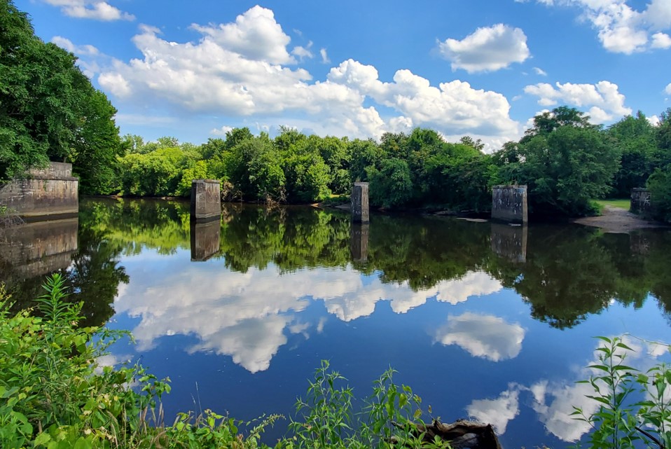
FOLAR is proud to partner with local governments, nonprofits and landowners to protect the Appomattox riverfront corridor. Protecting the riverfront not only preserves the natural beauty of the river through our region, but it also provides habitat, protects water quality, and makes our region more resilient from climate change. To date, 785 acres, or 24% of the lower Appomattox River corridor is protected from future development, including public parks and private conservation easements. FOLAR has been instrumental in protecting over 100 acres and creating new greenspaces for people to get outside and on the water since 2000.
Our conservation work is guided by the region’s first lower Appomattox River Land Conservation GIS Tool, created with grant funding from Virginia Environmental Endowment. FOLAR inventoried what has already been protected and created a model to identify conservation priorities. This tool is used throughout the region by our partner localities and nonprofit organizations to guide conservation work on a landscape scale.
Are you interested in protecting the riverfront you love?
Would you like to explore the Land Conservation GIS Tool?
CONTACT: Heather Barrar, FOLAR’s Regional Trails Program Director
PLANTS & WILDLIFE


Native Plants
Interested in volunteering at our native plant gardens?
CONTACT: Elise Neuscheler, Environmental Stewardship Coordinator: eneuscheler@folar-va.org
Sign up for FOLAR’s Volunteer Group to be notified of and register for upcoming volunteer events.
The Appomattox River offers a diverse habitat for native plants as it is located along the fall line, within the coastal plain and the piedmont regions and offers both rocky bottom whitewater and tidal flatwater. This means we have a diverse landscape and ecosystem. And even though much of the riverfront was industrial land in the late 1700’s through the early 1900’s, mother nature has restored many sites.
While on the trail, you will see many riparian plants and trees that like to grow at the water’s edge. These include sweet bay magnolia, sycamore, and river birch. We also have upland habitat, sometimes created by the canal system that boasts species like loblolly pine, oak, and hickory. There are large patches of paw paw fruit trees and other understory shrubs. In addition, there are many wildflowers such as yellow trout lily and cardinal flower. And do not forget the ferns like sensitive fern, cinnamon fern, and Christmas fern.
Learn more about how to identify what you are seeing along the river: The Virginia Department of Forestry website offers many tree identification resources. Another great resource to learn about native plants is the Plant RVA Natives and Plant HR Natives website.
We also love using identification apps like PictureThis or iNaturalist – you just take a photo of a leaf or flower and the app does the rest! If you want the deep dive, Flora of Virginia is a great app for browsing and learning about our natives.
Want to create an eco-friendly garden or ecosystem right in your backyard? You can use the Virginia Department of Conservation and Recreation’s Virginia Native Plant Finder to aid your next landscaping project. This tool helps you identify potential native plants for your project area in a way that increases the biodiversity of your ecosystem.
FOLAR and volunteers planted a native garden at the University Blvd Trailhead in Petersburg in 2021. These demonstration gardens provide great habitat for pollinators, protect water quality, and can help you get to know different native plants. View our University Blvd Native Plant Inventory for plants that can be found in the three different beds. These native plantings are maintained in partnership with the Pocahontas Chapter of the Virginia Master Naturalists. Please let us know if you want to volunteer to help keep them free of weeds and thriving!
FOLAR’s Native Virginia Seed Packets
In September 2023, FOLAR created seed packets containing seeds of plants native to the Virginia area. The packets are intended to help introduce folks to gardening with natives and improve their environment from their own outdoor spaces. We will be bringing them to events for distribution, or email us at contactus@folar-va.org if you are interested in receiving one.
These packets have the potential to re-introduce native plants to 250,000 square feet of garden space collectively – that’s about six football fields! Gardening with native plants has many benefits. Native plants are adapted to the local climate and soil conditions, so they are more likely to thrive with less water and fertilizer. They provide food and habitat for native wildlife, which helps to support biodiversity. Removing lawn, which tends to be biologically sterile as a monoculture as well as an expense for the soil, and replacing it with native plants, is an act of environmental restoration. Gardens will absorb more rainwater than lawns, reducing/eliminating the need for additional watering and helping urban areas avoid flooding during storms.
Check out our seed packet information page, folar-va.org/seedpackets – to learn more about the seeds included and how to use them.
Wildlife Habitat
If you are lucky, you might see some critters while out on the trail. Our wildlife ranges from reptiles and amphibians like turtles and spring peepers to mammals like deer, beavers, river otters, and much more. Our fish population includes many species like shad, gar, catfish and the returning sturgeon. Grab your binoculars because birds are also abundant, including many songbirds, blue herons, green herons, osprey, cormorants, and raptors like bald eagles, owls, and hawks. The Appomattox River acts like a wildlife corridor – much like of how we think of traveling along roads. All sorts of animals including birds, reptiles and mammals depend on this connected greenspace to travel as they hunt for food and habitat. And for species that migrate, these wildlife corridors assist in the migration process. We are also in an Important Bird Area (IBA) as identified by the National Audubon Society. The Virginia Department of Wildlife Resources has a great website with information about our local wildlife, habitat and many maps and plans for reference.
If you want to let us in on your photos on social media, add the tag #folarva and #AppomattoxRiverTrail, and follow us at @folarva on Instagram.
Invasive Plant Removal
Volunteer with us at FOLAR’s Stewardship Saturday work sessions!
CONTACT: Elise Neuscheler, Environmental Stewardship Coordinator, and learn more about our Stewardship Saturdays.
Invasive species are plants and pests that are not native to an area and can cause environmental and ecological harm. They do not have any natural predators and often do not provide a food source to native animals. We are working at FOLAR to identify all of the invasive species along the river and come up with a management plan. Managing invasive species takes hard labor and many years to control.
View a list of Virginia’s invasive plant species from the Virginia Department of Conservation and Recreation.
View the Invasive Plant Management Plan for the Appomattox River Trail System.
RIPARIAN BUFFERS & WATER QUALITY

Plants and trees in the riparian buffer are important for the health of the river and the land. They shade the river, keeping water temperatures cool for fish and wildlife. They slow floodwater and trap sediment and other pollutants from reaching the river. While it may be nice to have a clear view of rivers, streams or lakes, it’s important to keep trees on our shoreline and maintain a riparian buffer to protect water quality.
A riparian buffer is required in certain areas of the Chesapeake Bay watershed (generally along or east of I-95) and are regulated by the Department of Environmental Quality (DEQ) and local governments. The riparian buffer is referred to as a Resource Protection Area (RPA) in the regulation. You can learn more by visiting DEQ’s Chesapeake Bay Preservation Act regulations. Luckily, there are many resources and organizations that can help you establish and maintain a riparian buffer if you have a perennial stream (it flows year-round), lake or river on your property.
The Appomattox River is part of the James River Watershed, and FOLAR partners with the James River Association (JRA) and their riparian buffer and shoreline restoration programs.
- Apply for the JRA Buffer program (Currently available for landowners in Chesterfield and Dinwiddie Counties only)
- Apply for JRA Living Shoreline Cost Share Program (Currently available for landowners in Prince George County only)
Another great program for homeowners or commercial property owners to improve water quality is the Virginia Conservation Assistance Program (VCAP) offered by the Virginia Association of Soil and Water Conservation Districts. This cost share program can assist in installing practices like rain gardens, permeable pavers, or green roofs (click here to see the full list). If you have an idea for a project, contact the Appomattox River Soil and Water Conservation District (Dinwiddie County & City of Petersburg) or the James River Soil & Water Conservation District (Chesterfield County and Prince George County) to get started on an application.
Water quality and quantity is monitored by the USGS from Ferndale Bridge near Matoaca. Water quality is also monitored by Virginia State University as well as the James River Association (JRA). Explore the James River Watch map, which gives you helpful water quality data across the entire James River Watershed. Water quality measurements, like e coli concentration and turbidity, are taken once a week between Memorial Day in May and Labor Day in September at the following locations on the lower Appomattox River: Harvell Dam by JRA Volunteers in partnership with Virginia State University; Hopewell Rt. 10 by Virginia American Water; and City Point by JRA Volunteers.
Additionally, the Riparian Forests for Landowners Program is an offering from the Virginia Department of Forestry that helps landowners plant riparian buffers around their riverfront property. The DOF Riparian Forests for Landowners (RFFL) program provides flexible, no-cost riparian forest buffer installation and one year of maintenance to landowners. The program is being implemented by DOF and partner organizations in a unique watershed-based partnership.
CLIMATE CHANGE ADAPTATION

We have all experienced the changes in weather – more storms and intense rain, flooding in areas that have never flooded in the past and more extreme temperatures. We also know that protecting the river is a solution to help mitigate impacts on our community. FOLAR was selected to participate in the Northern Institute of Applied Climate Science (NIACS) Adaptation Planning & Practices for Recreation Course to learn about the potential impacts of climate change on both recreation infrastructure, as well as impacts to those people who like to get outside to walk, bike, paddle or camp.
In 2021, FOLAR developed a Climate Change Adaptation Plan to help us look through the lens of climate change impacts to be sure we are developing the most sustainable system and making sound investments in our park and trail system. The Appomattox River Trail was also recognized in Virginia’s first Coastal Resilience Master Plan, making a connection between the importance of recreational open space and community resilience.
RIVERFRONT CHAMPIONS PROGRAM

Riverfront Champions Program
Do you own property along the Appomattox River corridor? We’re gathering people like you together to unite as a community group, “Riverfront Champions,” where we can share river care resources, learn from each other about preserving views while reducing erosion and strengthening shorelines, and ultimately, work together to protect our shared resource. Sign up for the Riverfront Champions group email list to connect and communicate about river care resources, upcoming workshops/volunteering opportunities/events, and other issues of interest. In 2022, FOLAR kicked off the Riverfront Champions Program with a 3-part workshop series for riverfront owners and river lovers alike. Listed below are the presentation topics and additional resources. Please let us know if there are any topics that you would like to see at future Riverfront Champions programs.
INVASIVE & NATIVE PLANTS
FOLAR hosted a field workshop on how to identify plants and control invasive species so native plants can thrive. Sample plants, demonstrations and worksheets were shared. Our print-ready Host Plant booklet handout can be found here; please note that the pages of this document are aligned for double-sided printing with center binding.
CONSERVATION EASMENTS
FOLAR partnered with the Capital Region Land Conservancy (CRLC) to host a discussion on conservation easements and the process to protect land for future generations. Please click here for the presentation from this event.
THE CHESAPEAKE BAY PRESERVATION ACT
The DEQ Office of Watersheds and Local Government Assistance Programs joined FOLAR to share how the Chesapeake Bay Act and regulations apply to how we manage and develop our land. Most of the Tri-Cities Region is in the Chesapeake Bay Watershed. Click here for the presentation from this event.
LANDOWNER RESOURCES
There are many agencies, resources, and funding opportunities available to commercial & residential landowners to manage riverfront land. Please visit some of these partner organizations for more information.
The Appomattox River is part of the James River Watershed, and FOLAR partners with the James River Association (JRA) and their riparian buffer and shoreline restoration programs.
Apply for the JRA Buffer program
Currently available for landowners in Chesterfield and Dinwiddie Counties only
Apply for JRA Living Shoreline Cost Share Program
Currently available for landowners in Prince George County only
Apply for the Riparian Forests for Landowners Program
Another great program for homeowners or commercial property owners to improve water quality is the Virginia Conservation Assistance Program (VCAP) offered by the Virginia Association of Soil and Water Conservation Districts. This cost share program can assist in installing practices like rain gardens, permeable pavers, or green roofs (click here to see the full list). If you have an idea for a project, contact the Appomattox River Soil and Water Conservation District (Dinwiddie County & City of Petersburg) or the James River Soil & Water Conservation District (Chesterfield County and Prince George County) to get started on an application.
Native Plants for Southeast Virginia
Native Plants for VA’s Capital Region
Our Partners
