BUILDING THE TRAIL

TRAIL DEVELOPMENT UPDATES

TRAIL CENTER | Patton Park, Old Towne Petersburg, and Pocahontas Island: This 2-mile section of the trail is shovel ready with 1.3 miles fully funded. The Appomattox River Trail will intersect with the future Fall Line at Patton Park, also fully funded for a 10-mile section from Petersburg to Chester. As we move west of Patton Park, 1/3 mile of trail has been completed at the University Blvd Trailhead and another 1/3 mile is fully funded.

TRAIL EAST | City of Hopewell: Phase II of the Hopewell Riverwalk’s connection to Hopewell City Marina and a network of bike lanes have been completed. Partners are seeking funding for the final phase of the Hopewell Riverwalk to connect to the Hopewell City Marina. Construction plans are under design to enhance the entrance of the Appomattox River Regional Park. Further planning and study is being sought for the development of the section of trail through Prince George County.

TRAIL WEST | Dinwiddie County: A master plan and studies have been completed at Ferndale Park (also known as Appomattox Riverside Park) to set the stage for future park and Appomattox River Trail renovations. Partners are seeking funding for this project.


TRAIL FUNDING PROGRESS

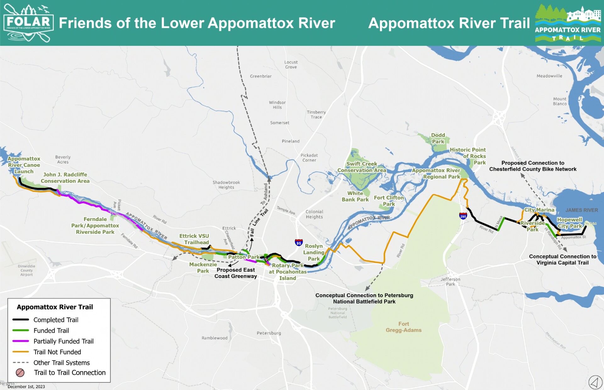
The map below shows the progress made in funding the Appomattox River Trail. (Click to enlarge)

  • Completed: 9.5 miles (black)
  • Fully Funded: 3.3 miles (green)
  • Partially Funded: 2.9 miles (purple)
  • Not Funded: 12 miles (orange)

THE APPOMATTOX RIVER TRAIL & PARK SYSTEM IS A DEVELOPING 25-MILE BLUEWAY-GREENWAY

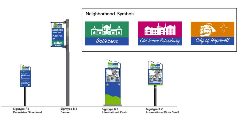
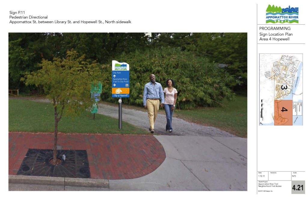
The Appomattox River Trail winds through 6 communities in South Central Virginia: Chesterfield County, Dinwiddie County, Petersburg, Colonial Heights, Prince George County, and Hopewell, from the Brasfield Dam at Lake Chesdin to the confluence of the James River.  This blueway-greenway includes a network of bicycle-pedestrian paths, 16 riverside parks, 11 historical sites, 8 boat access points, and 3 marinas.  Our vision is to unify the region with coordinated wayfinding signage on water and land as we develop each section. 

We believe the Appomattox River Trail is a path to physical and mental wellness, environmental conservation, and economic prosperity for the entire Tri-Cities region of Virginia.  Designed for active transportation and outdoor recreation, the Appomattox River Trail greenway offers a diverse array of connections, linking residents and visitors to nature, rural wilderness, historic downtowns, jobs, schools, shopping, restaurants, parks, and so much more. With over 5 miles on the ground, the Trail system is already bolstering the quality of life in the Tri-Cities region. 

Guided by a Master Plan adopted in 2017, FOLAR works in collaboration with local and state government, foundations, individual donors, landowners, engineering firms, construction firms, environmental and outdoor recreation groups, nonprofit organizations, and the public to bring the vision to life.

As we develop the trail system, we measure trail usage with TRAFx infrared trail counters and semiannual volunteer trail counts. FOLAR sends that data to VDOT for their interactive Statewide Bicycle and Pedestrian Count Network map.

WELLNESS

When we invest in public access to greenspace, we can improve our community’s health with a 25% increase in the number of people who exercise 3 x a week.  This is critical for the Crater Health District, which is ranked lowest in Virginia for nearly all health outcomes.

CONSERVATION

As we develop the Appomattox River Trail, we are also working with landowners to conserve riverfront land and permanently protect it.  This also protects our drinking water, biodiverse wildlife habitats, and our scenic river views.

PROSPERITY

Building a world-class trail will attract day-trippers, spark outdoor tourism, and boost spending at local businesses.  Our neighboring VA Capital Trail reported a 3.7% increase in property values along their trail.

Master Plan

The Appomattox River Trail Master Plan is a guide to locating and prioritizing shared-use trails with a coordinated signage system through the six municipalities that border the lower Appomattox River. The area encompasses the counties of Chesterfield, Dinwiddie and Prince George, and the cities of Colonial Heights, Hopewell and Petersburg. The document is presented in two parts. Part I focuses on the trail plan, and Part II focuses on the corresponding signage plan – a unique aspect of the project. The planned trail and signage offer walkers and cyclists safe, enjoyable connections to recreational opportunities, greenspace and nature, as well as connections to historic sites and structures, businesses, jobs, schools and transit.

The Master Plan was developed through a $100,000 proactive grant from The Cameron Foundation, and with the combined efforts of FOLAR and two consulting design companies – Land Planning and Design Associates as well as AB Design – along with significant input from regional stakeholders and the public.

Through a grant from the Crater Health District (CHD) under the Virginia Department of Health, FOLAR was able to expand the scope of the Appomattox River Trail planning project to include more engagement with Hopewell and Petersburg residents. The expanded scope focuses on neighborhoods along the river in the Cities of Hopewell and Petersburg in order to help provide increased opportunities for residents to add more physical activity into their daily routines.

Awards & Recognition


Three projects along the Appomattox River Trail have received a Governor’s Environmental Excellence Award:

  • 2022, Silver Award, University Blvd Trailhead & Overlook in Petersburg
  • 2020, Gold Award, Hopewell Riverwalk
  • 2019, Bronze Award, Virginia State University Simms Hall Overlook

Our Partners